ezcamp app icon

For iPhone · Free on the App Store

Camp somewhere
you can trust.

29,105 campsites across the US, and the answers you want before you drive out: can I camp here, what will tonight be like, is it safe, and what to pack. Just ask.

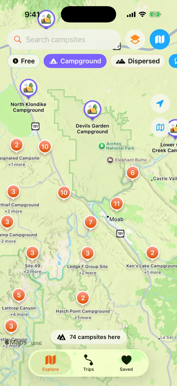
The ezcamp map near Moab with 3D campground pins and clusters

29,105

campsites across the US

43,999

hikes, paddles and rides nearby

50

states, plus Puerto Rico and Guam

12

public data sources, all shown

Before you drive out

Three questions, answered on the spot.

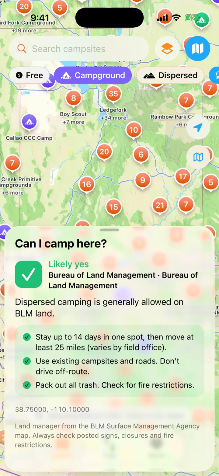
Can I camp here?

Long-press anywhere on the map.

ezcamp asks the Bureau of Land Management who manages that exact spot and tells you what that usually means: BLM and national forest land is generally open for dispersed camping, parks and refuges need a campground or permit, private land needs permission. In a national forest it also finds the nearest forest road and who may drive it, and when.

Source on every answer. Local closures and fire rules always win.

Can I camp here? answered Likely yes on Bureau of Land Management land near Moab, with the stay-limit rules

What will tonight be like?

The night, not the afternoon.

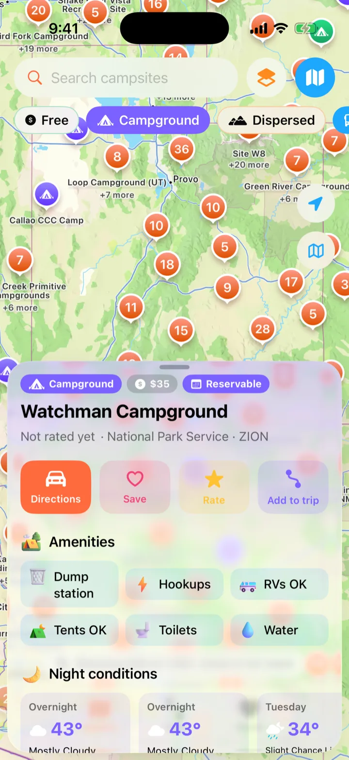
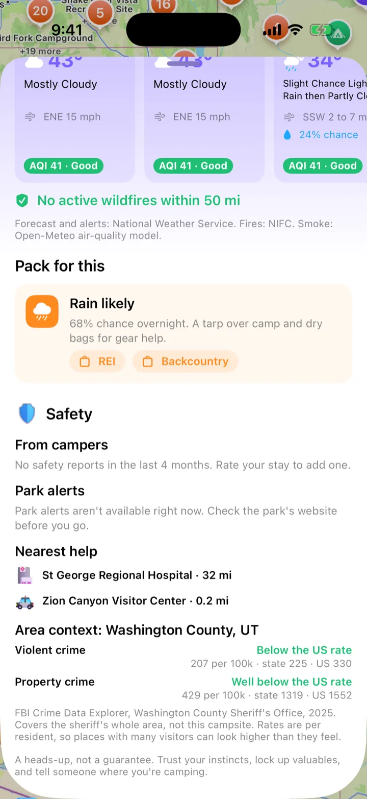
Every campsite shows the next nights’ lows, wind and rain chance from the National Weather Service, active weather alerts, wildfires within 50 miles and overnight smoke. Freezing or wet? It suggests what to pack.

Forecast: NWS. Fires: NIFC. Smoke: Open-Meteo.

Watchman Campground in Zion on ezcamp, with amenities and night conditions

Is it safe?

A heads-up, with the receipts.

What other campers saw in the last four months, like car break-ins or rangers on patrol. Current Park Service alerts. The nearest hospital and police or ranger station. And county crime context from FBI data, compared with the state and the US, with its limits spelled out.

About places, never about people.

The Safety section: camper reports, park alerts, nearest hospital and ranger station, and county crime context

Road trips

A camp at the end of every day’s drive.

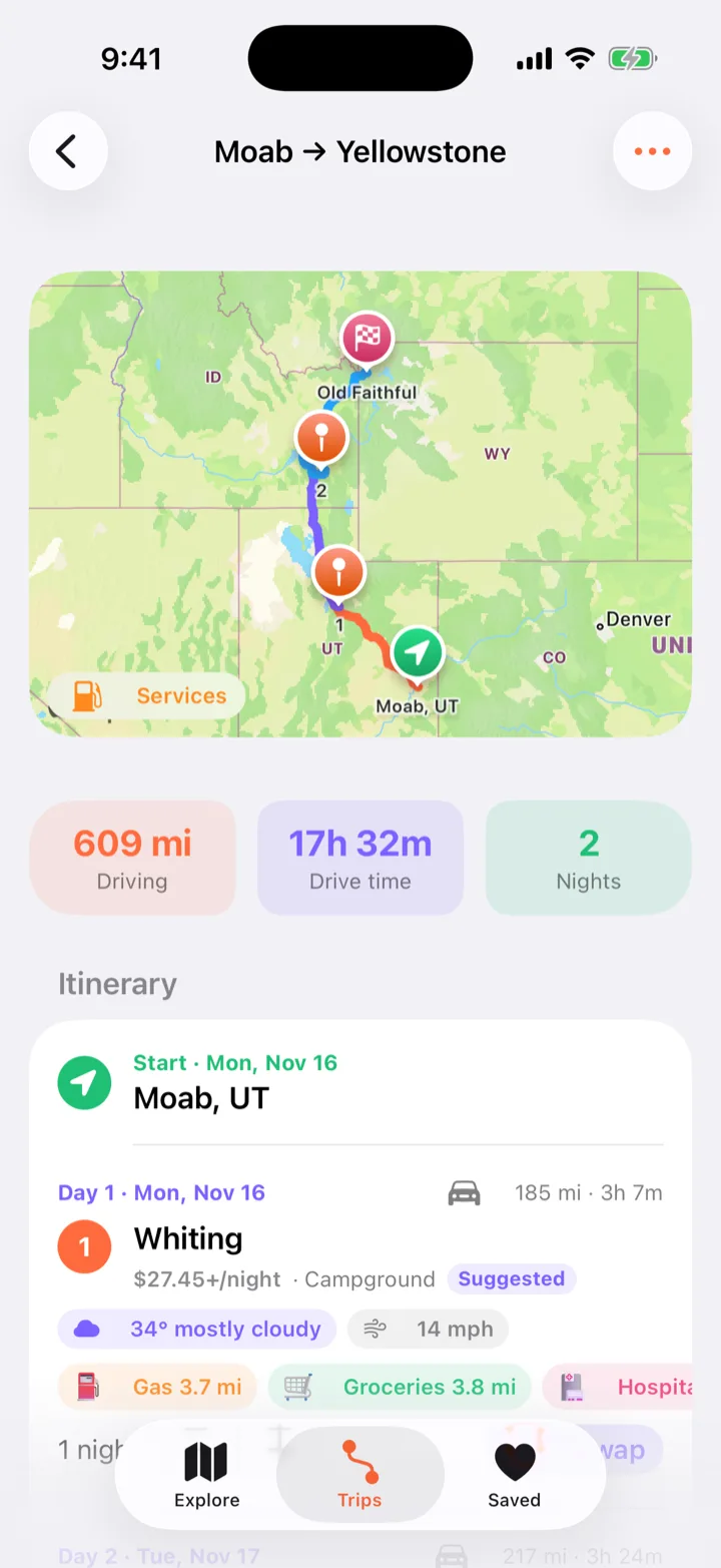
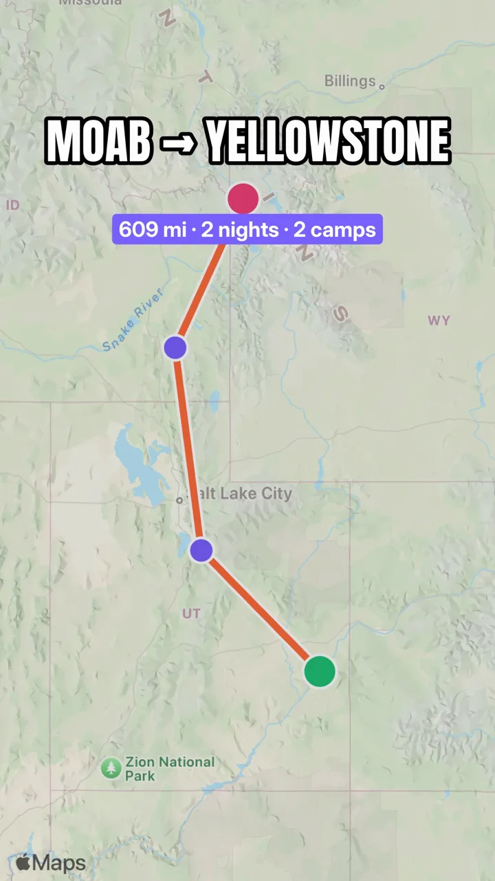
Pick where you’re going and how far you like to drive in a day. ezcamp maps the route, splits it into even days and suggests a camp near the end of each one, free ones first. Every stop shows that night’s forecast and the gas, groceries, hospital and police nearby.

Swap any camp, add your own, change the nights. Spots without details are never suggested.

A Moab to Yellowstone trip: 609 miles, 2 nights, with a suggested camp and nearby services for each day

New in ezcamp

Ask it, fish it, pack it, share it.

Ask ezcamp

Just ask. The map follows.

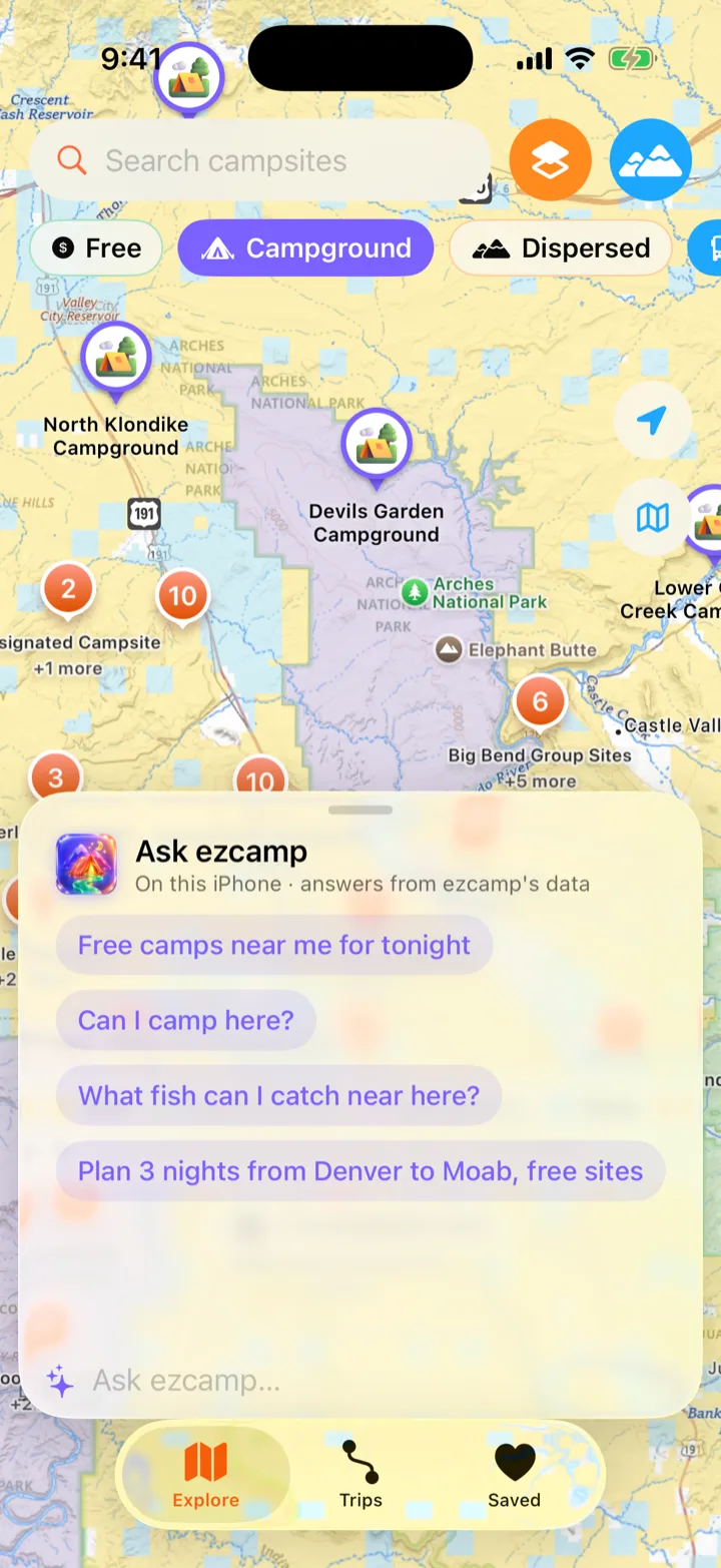
“Free camps near Moab with water?” “Can I camp here?” “Plan 3 nights from Denver to Moab.” A glass panel over the map answers from ezcamp’s own data, says where each answer comes from, and moves the map to the sites it’s talking about. It runs on Apple Intelligence on your iPhone, or with your own Claude or OpenAI key.

It only names campsites ezcamp actually has. No made-up spots.

Ask ezcamp, a chat panel over the map near Moab with suggested questions

Fishing & hunting

What’s biting, and what you need to fish it.

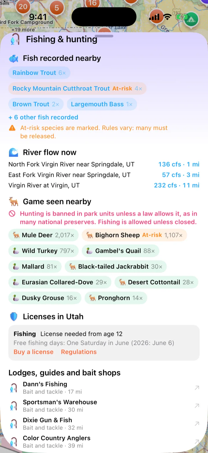
Every site shows the fish and game people have recorded within 25 km, at-risk species flagged, live river flow from USGS gauges, and the state’s license rules with links to buy one. Nearby bait shops, guides and lodges are a tap away.

License rules for all 50 states and Puerto Rico, from each state’s wildlife agency.

Fishing and hunting near Watchman Campground: trout, river flow, game seen nearby, Utah license rules and bait shops

Pack lists

Exactly what to bring. And why.

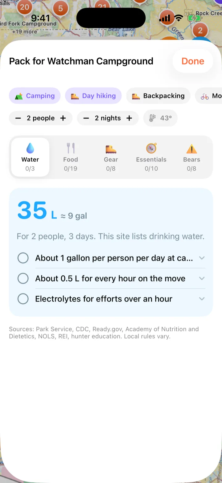
Pick what you’re doing: camping, hiking, biking, fishing, hunting. ezcamp sizes water to your people, nights and the forecast, then lists meals, snacks, gear and the Ten Essentials. Snap your own gear and it becomes cut-out stickers on shelves you tick off as you pack.

Every line cites its source: the Park Service, CDC, Ready.gov and more.

A pack list for Watchman Campground: 35 liters of water for 2 people over 3 days, with sources

Trip reels

Share the trip with the people you love.

Add your photos and videos as you go and ezcamp keeps them with each camp. One tap turns the trip into a reel: your route on the map, every camp by day, the moments that made it. Want music on the beat, captions and a YouTube cut too? Open it in ezReels.

Made on your iPhone. Your photos never leave it.

The opening frame of a trip reel: Moab to Yellowstone on a map, 609 miles, 2 nights, 2 camps

Ratings

Stars from people who were there.

Rate a campsite while you’re at it and your rating is marked verified. Verified ratings count double, and every rating fades a little each year, so a road that washed out two weeks ago outranks a glowing review from three years back.

How the score weighs two ratings (example)

★★★★★ Verified · 2 weeks ago ×2.0
★★★☆☆ Not verified · 3 years ago ×0.13

One rating per person, per site, per night. Shared without your name. Reported ratings get hidden.

Also in your pack

The small things that save a trip.

  • Things to do, easiest first

    Trails, paddles, climbs and ranger programs within 25 miles, ranked by difficulty, with how the grade was worked out.

  • Forest roads

    The Forest Service’s Motor Vehicle Use Map on top of yours: which roads are open, to what, and in which season.

  • Topo and public lands

    USGS topo maps and a color layer of who manages the land, so you can see the BLM boundary before you reach it.

  • Cell signal

    Official Park Service notes plus per-carrier reports from campers, for when you need to work or call.

  • Plan with AI, optional

    Type “SF to Moab via Zion, 5 nights, free sites”. The model only reads your request; the camps come from the data.

  • Stops along the way

    Gas, groceries, hospitals and police near every camp on your trip, with the distance and a tap to Maps.

Where it comes from

Every answer shows its source.

Open and public data only, so you can check anything ezcamp tells you.

  • National Park Service
  • Recreation.gov (RIDB)
  • USDA Forest Service
  • Bureau of Land Management
  • OpenStreetMap
  • National Weather Service
  • NIFC wildfires
  • Open-Meteo air quality
  • USGS The National Map
  • FBI Crime Data Explorer
  • US Census Bureau
  • Apple Maps

Questions

When can I get it?
Now. ezcamp is free on the App Store for iPhone (iOS 26). Tap Download on the App Store at the top of this page.
Do I need an AI subscription for Ask ezcamp?
No. On iPhones with Apple Intelligence it runs on the device for free. Otherwise you can add your own key for Claude, OpenAI or another provider in Settings, and pay them directly. Everything else in ezcamp works without AI.
Where do the campsites come from?
Only open and government data: the Park Service, Recreation.gov, the Forest Service, BLM and OpenStreetMap. Nothing is scraped from closed review sites, and spots with no name or details stay hidden until you zoom in.
Does it work without signal?
The campsites, details and things to do are on your iPhone, so you can browse them anywhere. Maps, weather, fires, park alerts and “Can I camp here?” need a connection.
Do I need an account?
No. You only sign in, with Sign in with Apple, to share your ratings with other campers. ezcamp never sees your name or email, and you can delete your account and everything you shared in Settings.
What does “verified” mean?
Your iPhone was within 500 meters of the campsite when you rated it. Verified ratings count double in the score, and every rating counts a little less each year.
Is the crime data about the campsite?
No. It’s last year’s FBI figures for the county sheriff’s whole area, compared with the state and the US. In small counties ezcamp shows counts instead of rates, and it says so on the card.